
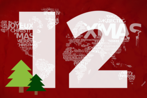
Live Santa Updates, Regional Traditions & So Much More!
Christmas is just around the bend and no matter where you are – from the California Coast to the French Alps – holiday cheer is in the air. As such, we compiled a group of data-driven maps to help bring in the holiday season and offer up a few interesting holiday tidbits!
Without further ado, here are The 12 Maps of Christmas:
1. NORAD Santa Tracker (Interactive)
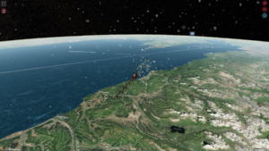
In 1955, Sears misprinted the phone number for children to call for updates on Santa’s whereabouts. The number instead went to the Colorado Springs’ Continental Air Defense Command (CONAD) Center. Colonel Harry Shoup, had his staff provide radar-based updates to those calling. The tradition continues to this day through NORAD’s GIS-based map.
2. Google Santa Tracker (Interactive)
NORAD’s rival, the Google Santa Tracker, also provides updates on Santa’s whereabouts. At midnight on Christmas Eve, this map shows Santa alternating between traveling and handing out presents in cities. While he spends one minute in each city, the time it takes to travel depends on the distance between cities.
3. Santa’s Different Regional Names
What do “Grandfather Frost,” “Christmas Log,” and “Yule Goat” all have in common? They’re all names of Santa Claus, just from different international regions. It turns out, the name for Old Saint Nick has quite a few variations, as this map shows.
4. Global Yuletide Traditions
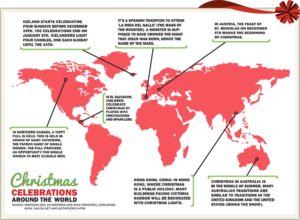
In line with the various names for Santa Claus, it turns out that names aren’t the only thing to changes from country-to-country during the holidays. This map showcases some of the unique Christmas traditions practiced in different countries across the world.
5. Countries without Christmas
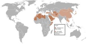
With all of this talk about Christmas, it can be easy to forget that some countries don’t recognize the holiday at all. You often see this in countries with non-Christian backgrounds, as this map shows.
6. Google’s Santa’s Village (Interactive)
This year, in anticipation of the Google Santa Tracker going live, Google created a digital version of Santa’s Village. It’s a cool collection of online games, activities, and resources themed around the holidays. Check it out when you have a minute to get distracted!
7. Christmas Feasts Across the Globe
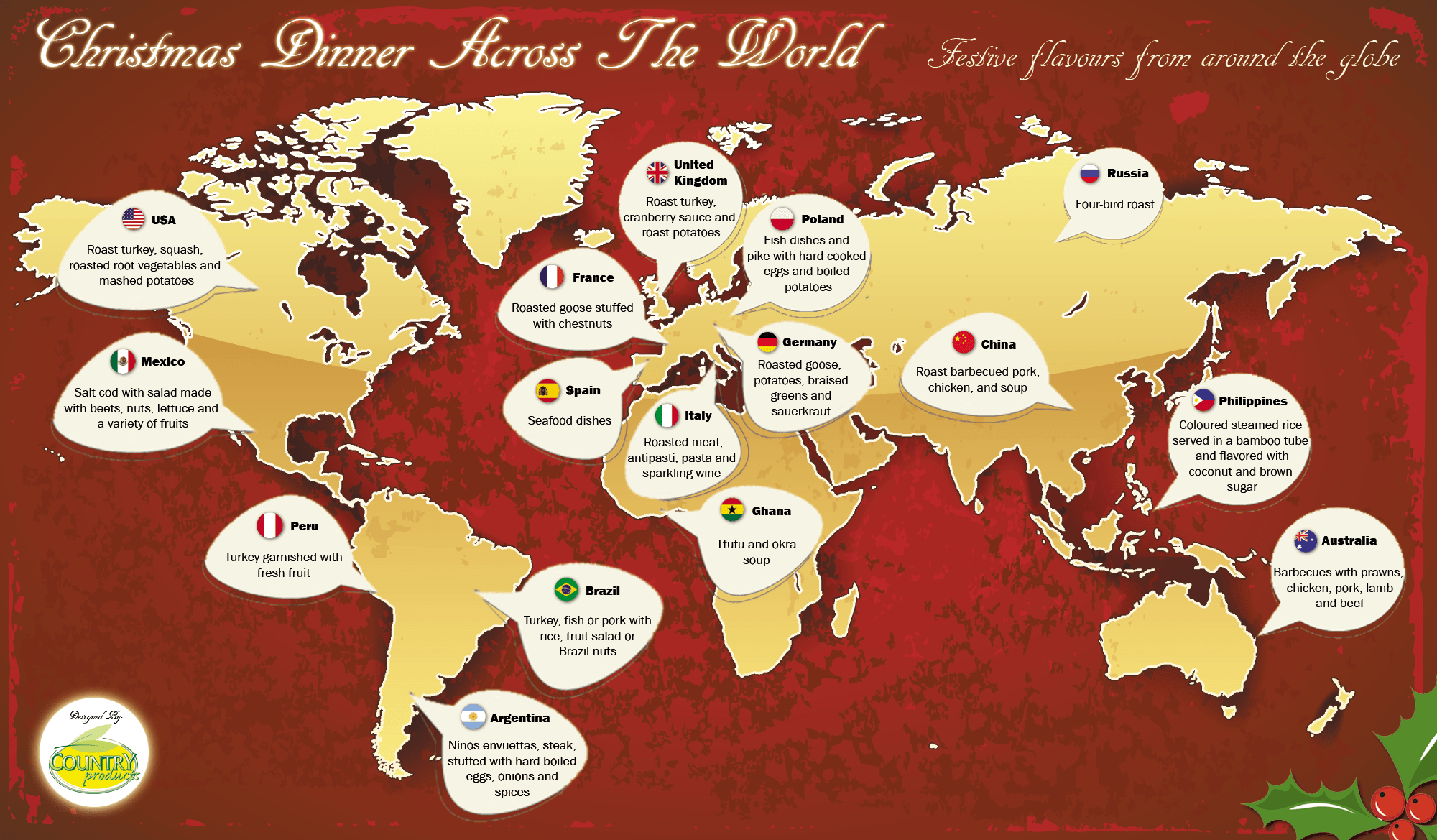
For many Americans, a traditional Christmas Dinner often consists of some combination of cranberry jelly, glazed ham, holiday stuffing, green bean casserole and roasted turkey. However, traditional Christmas food across the world looks quite different, as this map exemplifies.
8. Christmas Tree Growth by Region
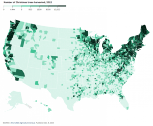
While most Americans buy a Christmas tree to place in their family rooms, less than a third of the country actually grows Christmas trees. This map shows us the states that are responsible for producing the trees.
9. Areas Getting Christmas Snowfall
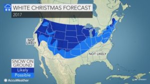
Snow is symbolic of Christmas across the US, and beyond. However, not every region is prone to weather conditions that produce snow. See which areas across the US are likely to receive snow using this map.
10.Disruptive Snowfall by Region
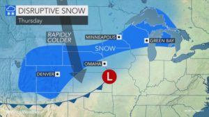
In line with the previous map, this map highlights the regions in the US which are expected to get “disruptive snowfall.” If you live in these areas, be sure to adjust your Christmas plans accordingly.
11. Favorite Christmas Artists by State
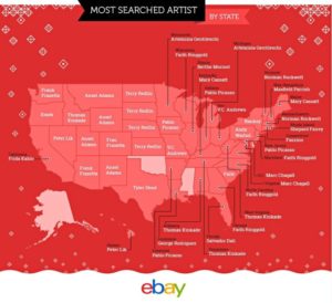
Whether you’re a fan of Terry Redlin or Andy Warhol, every US state seems to have a preferred holiday artist. This map, provided by eBay, shows the holiday artist of choice for each US state.
12. Global Christmas Traditions (Interactive)
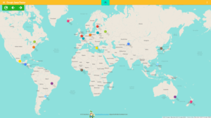
Expanding upon the fourth map in this list, this interactive map allows you to dive even deeper into the international traditions surrounding Christmas. For instance, did you know that in Germany they open special marketplaces on Christmas Day filled with regional goods and brass bands?


