
How Geoanalytics Provides Valuable Context to Your Data
Most businesses understand the value of implementing a CRM to keep track of their customer and prospect relationships. From documenting interactions with prospects, to recording opportunity progress and beyond, CRM software can solve a lot of problems.
But there are still gaps in what a CRM can do, particularly when it comes to data analysis and the insights you can gain from your data.
All the data in the world is useless if you can’t gain any actionable insights from it. With a CRM alone, you only have access to incomplete information.
Now, this isn’t to say you no longer need a CRM. But thinking that a CRM alone is going to answer all of your questions is a bit unrealistic. You need the right solution to help put your CRM data into context, surfacing key trends and patterns that you can actually act upon.
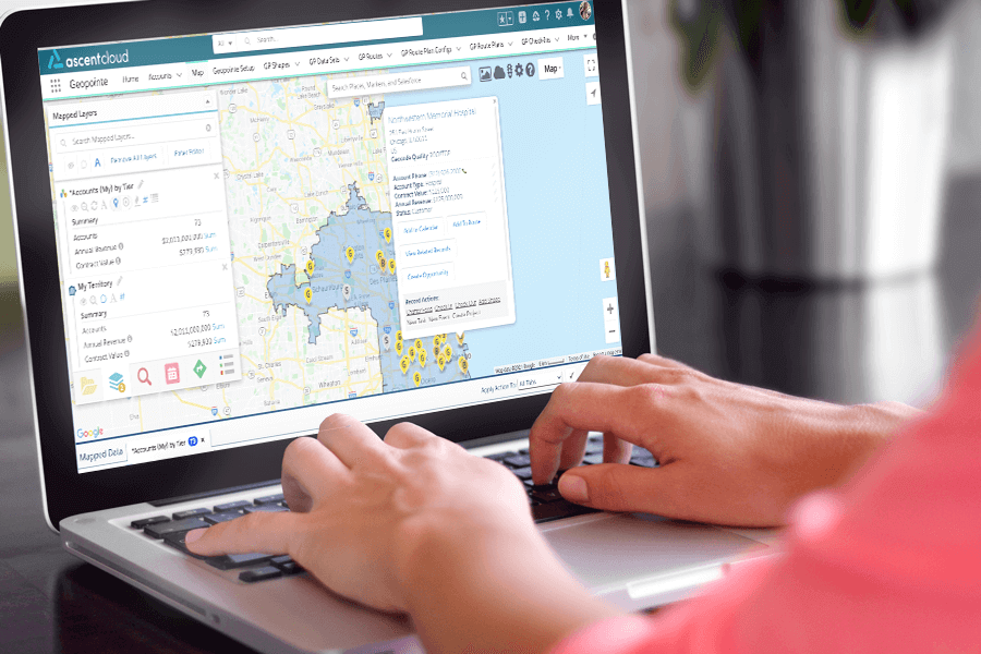
The best way to gain this context is with a Geoanalytics solution, which helps you geographically visualize your accounts, contacts, opportunities, and any other CRM data. When you add a Geoanalytics solution to your CRM, you achieve an easier, faster and more user-friendly way to interact with your data.
What Can A Geoanalytics Solution Provide That A CRM Doesn’t?
So, what is the context that is missing from your CRM data?
Most standard data analysis tools will break CRM data down into spreadsheets, charts and lists in an attempt to provide clear insights. But they’re missing the “where” in your data that connects it to a physical location.
Geoanalytics solutions will give you that “where.” These solutions will take your data out of flat, one-dimensional spreadsheets with thousands of rows and columns and put it onto a map, giving it another (visual) dimension.
There are many benefits to using a Geoanalytics solution, but the following three stand out as the most impactful.
1. Reduce the time spent on rote tasks that could be spent selling instead
The most important thing that Geoanalytics solutions can do is save you time so that you can get back to the most valuable activities that directly contribute to revenue. When repetitive tasks like assigning leads, planning travel routes, and others can be done automatically you gain back hours in your day.
2. An easier, faster way to recognize and understand patterns, trends or gaps in your data
In a matter of seconds, you can instantly understand which areas of your sales territories are most profitable. Geoanalytics solutions layer sets of data on a map so you can compare and contrast based on geographic boundaries, locating and mapping data anywhere in the world.
This visualization of complex data makes it easier for the brain to digest and interpret, catching patterns quickly. After all, psychology teaches us that most people’s brains are much more visual, and can process visuals 60,000 times faster than text. Putting those rows of numbers onto a map instead makes your CRM data easier to understand.
3. A more user-friendly way to work with large amounts of data
You shouldn’t need a data science degree to work with your CRM data. Pivot tables, V look-ups, etc. make working with spreadsheets slightly less difficult, but you’re still left sorting through thousands of data points.
Instead, Geoanalytics solutions allow you to work with your CRM data from right within the CRM – no need to mess with importing and exporting. With Geopointe, you can perform actions within the map interface like Mass Update, Add To Campaign, and others to help streamline your data entry.
What Your CRM Cannot Do – But Geoanalytics Can
Of course, the list of capabilities that Geoanalytics adds to your CRM is long, but the following are a few of the most important functions that come from using a Geoanalytics solution.
Automatically assign incoming leads to reps
Sure, a CRM makes it easier to keep track of who owns which lead, but it doesn’t go far enough. With a Geoanalytics solution, you have the ability to automate the lead distribution process. For example, Geopointe’s Assignment Plans are boundaries you can set that specify the territory or rep to which any leads belong.
The amount of time it would normally take to do this manually can instead be used for more valuable efforts, like selling.
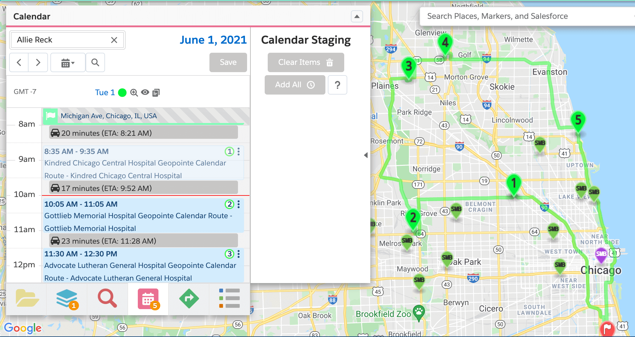
Create the most efficient route possible for your next on-site visit
Especially if you’re a field sales rep, you likely have to plan a lot of business trips to visit clients and prospects – a process that can be stressful and time-consuming. Trying to squeeze in as many meetings in a day as possible might seem like an admirable goal, until you miscalculate how long it will take you to get from one appointment to the next and end up missing an important client visit.
When you’re working with a CRM alone, this is bound to happen.
Luckily, routing is available from most Geoanalytics solutions to help you avoid this issue. Geopointe, for example, automatically builds in travel time between each appointment on your calendar. The solution will also build a route automatically for you that factors in traffic and travel times so that you’re visiting the key accounts you want to visit in the most efficient order.
Readjust territories with ease
With the right Geoanalytics software, you can see how any anticipated adjustments to existing territories will impact the potential for revenue, number of accounts and opportunities, or other metrics in real-time.
For example, Geopointe includes a feature, called Shape Editor, that allows you to make adjustments to territory boundaries and see the changes under roll-up summaries before you finalize the adjustment. This way, you can clearly understand how each change will affect your team as you go so you don’t have to keep going back and adjusting your territories.
Plan out your call list for the day
A CRM may give you data about the prospects you need to call, or the clients you need to check in with, but what it misses is the prioritization of those calls.
It can be difficult to get through your whole call list, so accounts and prospects may fall to the wayside. Without context, you can’t be sure whether those last couple calls you had to push to the next day were your biggest accounts or the accounts that generated the smallest ARR.
However, with Geoanalytics, you can use features such as heat maps to understand which accounts are the most lucrative, and prioritize those calls over others.
Location-Enable Your CRM With Geoanalytics
Adopting a Geoanalytics solution in addition to your CRM is the best way to realize the full value of your investment.
When your records are displayed on a map in a visual form, it’s easy to see the big picture. Patterns and trends are instantly clear, so you understand the information being provided quickly – information that would take hours to sort through in a standard report.
Geoanalytics helps you move past the question: “What is my data?” to, “Where is my data?” and “What does that mean for my business?” In other words, while your CRM provides the “What?,” Geoanalytics goes even further to uncover the “So what?” and “Now what?” so that you are able to take action based upon the information.
To learn more about Geoanalytics and how it enhances the value of your CRM, register for the upcoming Sales Management Association webinar “Enhancing Sales Force Insights with Geoanalytics.”


