Human and social services organizations often care about the geography of clients or services needed by clients. This can include picking up donated goods or finding the closest referral partner to a client’s home. I recently got to know Geopointe for a Dreamforce presentation. It’s a powerful tool for anyone who cares about the “where” of the data.
Here are three potential ways mapping can help human services organizations be more effective.
Use Case #1: Tracking case management site visits
Home visits are common practice for human service agencies. Visits are used for intake, family observations, checking in on service plan progress, and to perform an assessment.
Geopointe allows users to do mobile check in and check out at client locations. This makes it easy to track the visit date, start time, end time, and total visit time. Notes or other information can also be easily logged while checking in or out of a location.
Here’s the scenario:
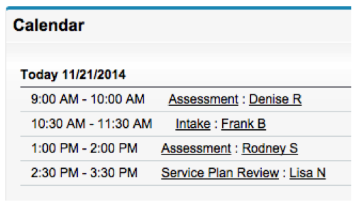
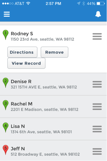
Rebecca is a case manager working with foster parents. She spends much of her time visiting clients’ homes. She tracks her daily client site visit schedule in Salesforce.
Here’s her calendar view for her day’s work in Salesforce:
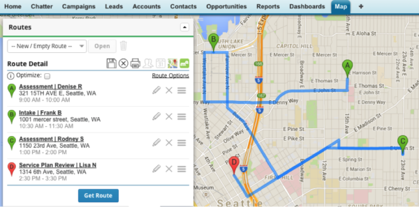
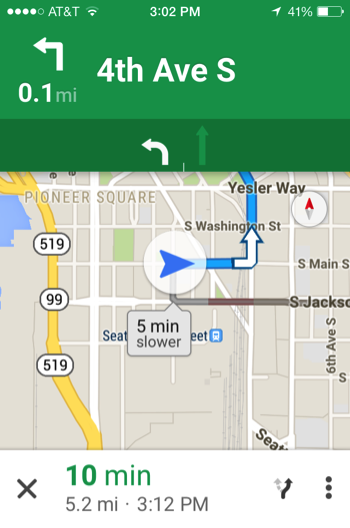
With a few clicks she can take this daily calendar view and create a map of the locations she needs to visit and the route she will take:
When Rebecca arrives at the first client site, she pulls out her smartphone and with a few clicks checks-in:

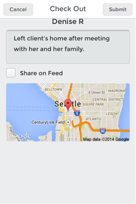
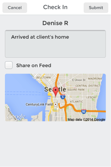
During the site visit, she uses Salesforce1 to complete the client assessment and have it attached to the client’s Salesforce record. At the end of the site visit, Rebecca checks out and adds a brief note:
The full visit is then recorded by Geopointe on the client’s record:

Rebecca uses this check-in record as starting point to add a detailed assessment when she returns to the office. She also uses it in the future to analyze how long site visits to a particular client take. Finally, Rebecca’s manager uses these records to report client visit metrics to funders.
Use Case #2: Route planning for client pickup or donated goods collection
A number of nonprofit organizations have a need to drive to a series of locations. Organizations that collect household goods need to create pickup routes for their drivers. Other programs provide door-to-door transportation for clients for services such as job training, or health related visits.
Geopointe allows routes to be built and saved, or generated as needed for cases where the locations vary day by day.
Here’s how this would work:
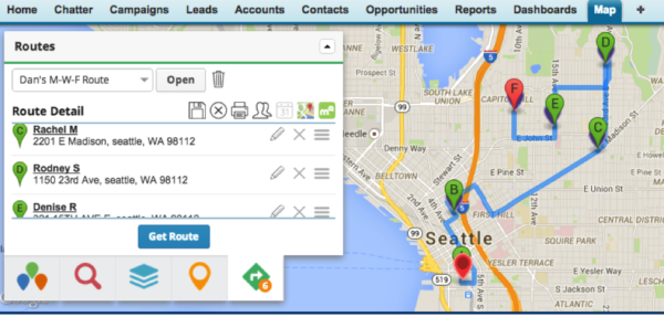
Dan works for an organization that provides preschool for children who come from troubled homes. One of Dan’s roles is to drive a van each day to pickup and drop-off the kids assigned to him. Geopointe allows routes to be created, optimized for the most efficient route, and saved for recall later. This allows the organization to know who is assigned to pick up which clients. Here’s what Dan’s route looks like:
Once the route is built, Dan uses the Salesforce1 mobile application to follow the route and get directions, as needed, from Google Maps.
When the van arrives at the client’s location, Dan checks in on his mobile device to record that he picked up the client. This information is saved to the client record and Dan moves on to the next pickup location.
Use Case #3: Referral by area covered or proximity to client
Human services organizations are often involved in referring clients to other community services who can assist them with their varied needs. In some cases, the client is looking for a particular type of service near to where they live, like the closest food bank or medical clinic. In other cases, some providers have specific boundaries in which they accept clients.
Here are two examples:
- Finding services closest to a client. A client asks to be referred to food banks near them. With client information and food bank information already in Salesforce, this is as simple as doing a radial search in Geopointe. Below is what this would look like. The client’s location is in red and food bank locations are in blue.
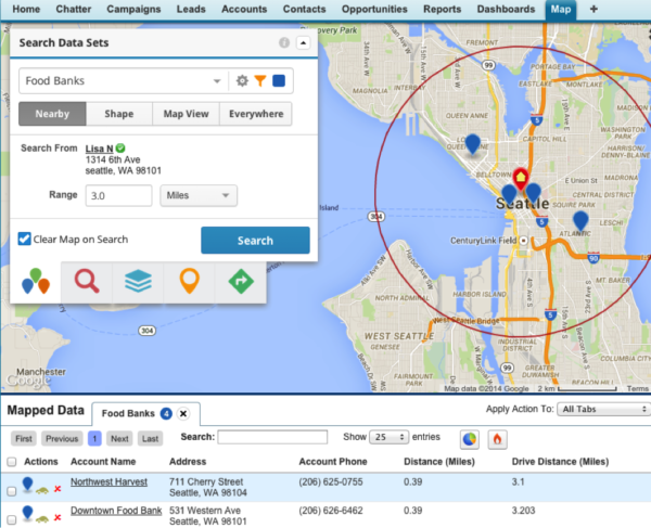
Clicking on one of the blue food bank locations gives the address and phone number of the food bank. The information for all providers within the search area is also found at the bottom of the window.
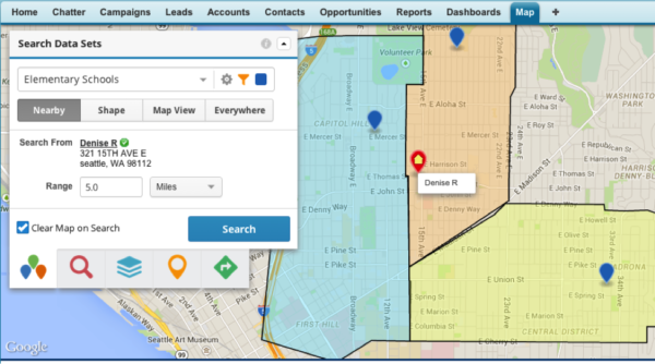
- Finding the service boundaries that a client resides in. An organization who works with young children wants to track which elementary school the child will attend. To quickly find out the elementary school boundary the family resides in, the staff can search the client against the school attendance boundaries that have been setup in Salesforce. This allows them to quickly identify the school the child will attend. In the screen shot below, the clients’ location is the red marker, schools are each of the blue markers, and the schools’ service boundaries are colored in yellow, orange, and blue.
These are just a few ways mapping can be used to improve the effectiveness of human services organizations. In a future post I will delve into more advanced examples including visualizing affordable housing data and overlaying census data on maps.
Brad Struss is Principal consultant at Bigger Boat Consulting


