We’re excited to share that the latest Geopointe features are now available on AppExchange. This latest release of Geopointe delivers more interactive mapping features, allowing end users to build and analyze territories directly on the map plus so much more.
A full list of new features and release details can be found in the Release Notes, but here are a few of our favorite highlights:
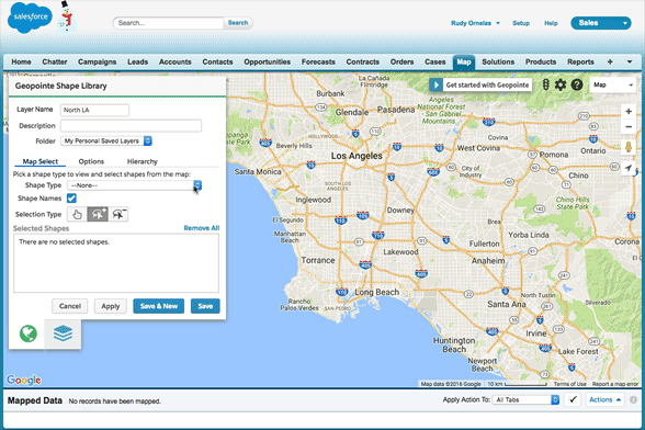
Visual Shape Editor
Easily select and deselect shapes by clicking areas directly on the map or by using our lasso tool to mass add or remove shapes from the shape layer. This approach saves time and improves the accuracy of shape creation. In this example below, we’ve divided South and North Los Angeles using zip codes. Other pre-defined areas include, counties, states, school districts, timezones, congressional districts and more. This is an especially great tool for current or former MapPoint users looking for a replacement tool. Learn more about Visual Shape Editor.
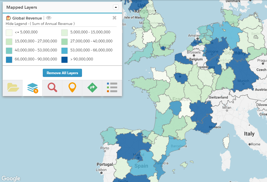
Thematic Maps
Thematic Maps allow users to roll-up a metric for any given data set and view the results based on a geographic area they define. For example, you can roll-up metrics such as record count, $ amounts, or % values, for data sets such as won opportunities closed this quarter or customers by revenue, and view your results on the map using geographic boundaries. This example below shows the sum of total annual revenue. Learn more about Thematic Maps.
Mobile Navigation Preferences
With so many people on the go these days, we’ve added even more options for Salesforce1 users. When using Geopointe in Salesforce1, users may now choose their preferred navigation app, Waze, Google Maps or, for iOS users, Apple Maps. Geopointe also supports ridesharing. Select a preferred rideshare provider, Uber or Lyft. Learn more about Mobile Navigation Preferences.